Desktop Surveys

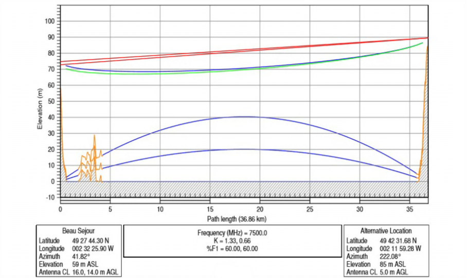
RAFT Systems provides comprehensive desktop surveys to support the planning and deployment of your wireless networks. Using the latest digital elevation data, we create detailed computerised path profiles to ensure that the topography along your proposed link is free from obstructions.
This initial analysis allows you to carry out a radio line of sight survey with confidence, confirming that no other barriers will impact your chosen path.
Additional Services
Where a path cannot be verified, RAFT can offer site identification services, locating alternative sites in the area to provide you with more options and ensure optimal network performance.
With RAFT, desktop surveys are a cost-effective, efficient first step in planning your network, helping to reduce risk and save time before on-site work begins.


